Select NOAA-NWS Forecast Office Text Products
(Product availability varies with seasons, forecast office, and weather.)
Forecast Discussion for Aberdeen, SD
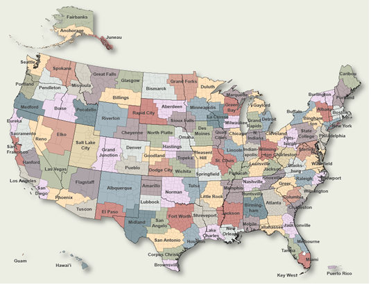
To Select Another NWS Office Click on Map or Choose from List
|
| Select Forecast Office: | Select Product: |
928 FXUS63 KABR 020022 AAA AFDABR Area Forecast Discussion...UPDATED National Weather Service Aberdeen SD 722 PM CDT Wed May 1 2024 .KEY MESSAGES... - Rain showers over mainly south central SD will expand across the rest of central to northeastern SD this evening, before diminishing west to east Thursday. Rain totals through Thursday will range from a 0.05 to near 0.5"(highest over north central SD). - Active pattern continues in the extended period, with at least two systems affecting the region. The first (Friday afternoon and night) will quickly move through the southeast half of SD and bring generally light rainfall (0.1" or less). The next system will be larger and prolonged, lasting from Sunday night and potentially into Tuesday. Rainfall amounts may exceed 0.5" during that event (50% chance) and there may be a few thunderstorms on Monday (20% chance). - Near to below normal temperatures Friday and Saturday, warming to above normal Sunday and Monday. && .UPDATE... Issued at 713 PM CDT Wed May 1 2024 See below for an aviation forecast discussion for the 00Z TAFs. && .SHORT TERM /THIS EVENING THROUGH THURSDAY NIGHT/... Issued at 203 PM CDT Wed May 1 2024 The weather map early this afternoon shows the surface ridge that had dominated our area this morning shifting into western MN. There is a trough of low pressure extending from the main surface low over southeastern CO to another over western SD. A third low was moving in from Canada/northern MT. Winds out of the south are beginning to take hold across areas east of the MO River. Surface winds will shift out of the southeast tonight as the CO low moves to central KS/OK by 12Z Thursday and northern lows join forces over western ND Thursday morning into the early afternoon hours. Moisture pushing north into the area, and the assistance by embedded waves in the southwesterly flow at 500mb, will help bring a return of showers to mainly central SD. This moisture return is a bit faster than previously expected, with the main focus being across central SD this afternoon. There are 2 main areas of precipitation, over north central SD and our southeastern Counties, with not much in between (on the order of 0.02" through midnight). The trend is for the northern system to become more dominant across our area, with 0.l2-0.5" of rain over Dewey, Corson, and Campbell Counties (highest over western Corson County). Cooler air will remain in place, with 850mb temperatures staying in the single digits above 0C through at least 12Z Friday. A few readings just below 0C will be possible over north central SD right around 12Z Friday. Highs will remain in the mid 50s to low 60s, with lows mainly in the upper 30s to low 40s. Rain shower chances will continue to diminish Thursday afternoon into Thursday night as a cold front drags across the forecast area, extending from the surface low over southern Manitoba/far northeastern ND late Thursday night. && .LONG TERM /FRIDAY THROUGH WEDNESDAY/... Issued at 203 PM CDT Wed May 1 2024 The start of the long term period (Friday) will continue the trend over the last couple of days, with a brief period of dry weather before another period of showers (Friday night). A surface low centered along the US/Canadian border of ND/MN at the start of the period will gradually lift northeast. Meanwhile, there will be upper jet support across southeast half of SD on Friday night, as a jet streak rounds the base of the upper ridge axis along the MT/ND/SD/WY border. This will also be supported by a nice area of mid-level warm air advection and q-vector convergence. All of these features come together over southeast SD and having rainfall chances of 30-50% to the southeast of Pierre/Aberdeen seems reasonable at this time. In addition, instability is extremely limited (MUCAPE values |
Previous Forecast Discussions may be found at
NWS Aberdeen, SD (ABR) Office Forecast Discussions.
(Click 'Previous Version' there to view past versions successively.
Some may differ only in time posted.)
Products Courtesy of NOAA-NWS
NWS Information Parsing Script by Ken True at Saratoga Weather - WFO and Products Scripts by SE Lincoln Weather.
Mapping by Curly at Michiana Weather and by Tom at My Mishawaka Weather.