Select NOAA-NWS Forecast Office Text Products
(Product availability varies with seasons, forecast office, and weather.)
Forecast Discussion for Aberdeen, SD
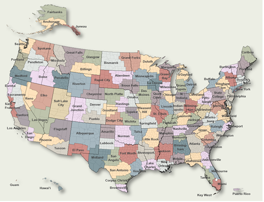
To Select Another NWS Office Click on Map or Choose from List
|
| Select Forecast Office: | Select Product: |
223
FXUS63 KABR 220523 AAC
AFDABR

Area Forecast Discussion...UPDATED
National Weather Service Aberdeen SD
1123 PM CST Wed Jan 21 2026

.KEY MESSAGES...

- Bitterly/dangerously cold air moves in Thursday night and
  persists through the weekend. At its coldest, wind chill values
  bottom out from 30 below to 45 below zero Thursday night into
  Friday.

&&

.UPDATE...
Issued at 1120 PM CST Wed Jan 21 2026

See below for an aviation forecast discussion for the 06Z TAFs.

UPDATE Issued at 751 PM CST Wed Jan 21 2026

Winds have really come down now, and just a couple of snow showers
working across northeast South Dakota. Basically, low level
thermal advection is neutral until early Thursday morning with
the nose of arctic surface high pressure extending down across the
region. Skycover is "scattered" coverage of cold air strato-cu,
and given the steepness of low level lapse rates (00Z KABR RAOB)
within this broad cyclonic flow aloft, certainly can`t rule out a
few flurries or snow showers overnight flaking out from under
these strato-cu clouds. Otherwise, there is a reinforcing cold
frontal boundary progged to sweep southward through the CWA
between ~07Z and 11Z Thursday that will start the strong low level
CAA happening again, which won`t stop until the -26C to -32C
925hpa air is down across the CWA Thursday night into Friday
morning.

UPDATE Issued at 533 PM CST Wed Jan 21 2026

See below for an aviation forecast discussion for the 00Z TAFs.

&&

.DISCUSSION...
Issued at 335 PM CST Wed Jan 21 2026

Winds are slowly diminishing across the region, but still gusting
between 45 and 55 mph across portions of the area. Although, this is
much less than some of the 60 to nearly 80 mph gusts from earlier
this morning. Also continue to see bands of snow showers working
southeast across the Dakotas. When these short-lived snow bands move
through a particular location, visibility drops significantly.
Winter Weather Advisory and Wind Advisory remain in effect through
00Z this evening across the CWA to account for the strong winds and
periodic quick/sudden reductions in visibility in falling/blowing
snow.

Focus then shifts to the arctic cold and bitterly/dangerously cold
wind chills settling in Thursday night into the weekend. 925mb temps
drop to around -30C Thursday night as the arctic high begins moving
southeast across the Dakotas. Low temps Thursday night still in the
teens below and 20s below zero, with wind chill values from 30 below
to as cold as 45 below across the CWA. Coldest readings occur early
Friday morning and will generally be across northern/northeast SD
into west central MN. Will leave cold headlines in place for the
time being and later shifts can fine tune where the split will be
for cold advisory vs extreme cold warning.

The bitterly cold temps stick around through the weekend, with highs
on Friday likely not even getting above zero. Single digits
above/below zero for highs Saturday and Sunday, with lows generally
in the teens below zero. Looking at apparent T grids throughout the
weekend, it would appear we`re close to potential advisory headlines
for cold at times, but that can be sorted out later once we get
through the initial (and most impactful) surge of cold Thursday
night and Friday.

&&

.AVIATION /06Z TAFS THROUGH 06Z FRIDAY/...
Issued at 1120 PM CST Wed Jan 21 2026

Terminals KABR,KATY,KPIR,KMBG

VFR conditions should prevail during the next 24 hours. Northwest
winds around 10 to 15 knots will become north winds 15 to 25 knots
Thursday morning.

&&

.ABR WATCHES/WARNINGS/ADVISORIES...
SD...Extreme Cold Watch from Thursday evening through Friday
     afternoon for SDZ003>011-015>023-034-036-037.

     Cold Weather Advisory from 6 PM CST /5 PM MST/ Thursday to 3 PM
     CST /2 PM MST/ Friday for SDZ033-035-045-048-051.

MN...Extreme Cold Watch from Thursday evening through Friday
     afternoon for MNZ039-046.

&&

$$

UPDATE...10
DISCUSSION...TMT
AVIATION...10
|
Previous Forecast Discussions may be found at
NWS Aberdeen, SD (ABR) Office Forecast Discussions.
(Click 'Previous Version' there to view past versions successively.
Some may differ only in time posted.)
Products Courtesy of NOAA-NWS
NWS Information Parsing Script by Ken True at Saratoga Weather - WFO and Products Scripts by SE Lincoln Weather.
Mapping by Curly at Michiana Weather and by Tom at My Mishawaka Weather.