Select NOAA-NWS Forecast Office Text Products
(Product availability varies with seasons, forecast office, and weather.)
Forecast Discussion for Aberdeen, SD
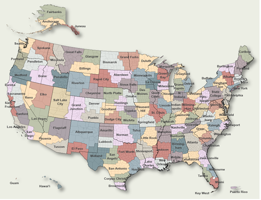
To Select Another NWS Office Click on Map or Choose from List
|
| Select Forecast Office: | Select Product: |
356
FXUS63 KABR 031425 AAB
AFDABR

Area Forecast Discussion...UPDATED
National Weather Service Aberdeen SD
925 AM CDT Mon Aug 3 2026

.KEY MESSAGES...

- A Red Flag Warning has been issued for this afternoon and
  evening over portions of central and north central South
  Dakota due to dry fuels and 20 to 35 mph north winds,
  including gusts up to 45 mph.

- Storms may develop along a cold front moving over the area
  late this afternoon into tonight. A Marginal Risk (Level 1 of
  5) is in place for parts of northeastern and central South
  Dakota, as well as western Minnesota. A Slight Risk (Level 2
  of 5) clips part of far northeastern South Dakota and western
  Minnesota. With these storms, the main severe threats will be
  hail of one inch in diameter and wind gusts of 60 to 70 miles
  per hour. Additionally, the development of a tornado or two
  cannot be ruled out in far northeastern South Dakota and west
  central Minnesota.

- An area of near surface smoke is expected to sweep through
  the region today behind the cold frontal passage.
  Concentrations of smoke may be high enough to be able to smell
  smoke in the air and reduce visibilities. Air quality is
  expected to drop through the day and tonight mainly west of
  the Missouri River. Those with breathing sensitivities should
  plan accordingly.

&&

.UPDATE...
Issued at 915 AM CDT Mon Aug 3 2026

Made some updates to PoPs for today to account for the elevated
WAA-forced showers/thunderstorms developing over the CWA this
morning. No other changes planned at this time to the today
period. Red Flag Warning continues as 20 to 30 mph northerly
winds develop today, post-cold frontal. Updates are out.

UPDATE Issued at 627 AM CDT Mon Aug 3 2026

Aviation discussion updated below for the 12Z TAFs.

&&

.DISCUSSION...
Issued at 147 AM CDT Mon Aug 3 2026

A cold front is currently sitting over ND and western SD and it will
be moving southeast through the day. In front of the cold front,
southerly winds over parts of south central and northeastern SD will
be picking up through the morning into the afternoon, with wind
gusts of 30-40 mph possible. There is also a 15-35% chance for some
scattered showers and storms to develop in ND during the morning
that could move along the SD border as well as into portions of
northern SD counties. Temperatures today should be around normal for
this time of the year, with highs in the mid 80s to low 90s. These
temperatures could be tampered by the morning shower/storm chances
as well as with the wildfire smoke moving in. Wildfire smoke will
continue to move over SD aloft today into Tuesday, creating hazy
skies. The southerly winds will help to keep a majority of this
smoke aloft. However, once the cold front move through, the north
northwesterly wind will be pushing more smoke in and some of that
will likely get to the surface. This will mainly be over areas west
of the Missouri River today, but potentially to the east later. This
smoke could cause a slight reduction in visibilities and be
irritating to those who are sensitive. The winds over central SD
will be picking up in the afternoon behind the cold front, with the
gusts getting up to 45+ mph in some places during the afternoon. The
minimum humidity during the afternoon will be dropping down between
25 to 35% over portions of central SD, with the lowest over areas
west of the Missouri River. While these humidity values don`t drop
into and below red flag criteria, below 20%, the strong winds as
well as drier fuel conditions over this area has lead to the
continuation of a red flag warning today.

The southerly winds will continue to push warm, humid air up into
portions of central and northeastern SD today, which will help to
prime the environment for storms to develop as the front continues
to move southeast late this afternoon into tonight. Both the NAM and
the RAP are showing CAPE values between 1000-2000 J/kg over central
and northeastern SD today, with the highest values over north
central SD along the front during the late afternoon to help with
storm development. The models are also showing stronger CIN values
over the area, which could inhibit the development of storms,
causing variation in the models as to how widespread storm
development is and when storms start. If storms do develop, there
looks to be lapse rates of 7-8 C/km as well as strong bulk shear
values, which could help the storms to become severe with strong
wind gusts and large hail. The strongest shear values will be behind
the front, which could limit the shear`s influence on storms unless
there are some storms that develop or linger behind the frontal
passage. There is a slight risk (level 2 of 5) for the
afternoon/evening storms to become severe over portions of
northeastern SD and west central MN and a marginal risk (level 1 of
5) over portions of south central and the rest of northeastern SD.
These storms will have the primary threat for wind gusts of 60-70
mph and large hail up to 1 inch in diameter. Additionally, the
development of a tornado or two over far northeastern SD and west
central MN cannot be ruled out. Most of the storms should move out
of central and northeastern SD during the late evening into the
early overnight hours as the front move southeast out of the area.
However, there could be some lingering scattered showers Tuesday
morning over south central SD depending on how fast the front moves.

Colder air will be pushing in behind the cold front and will help to
cool temperatures over central and northeastern SD about 5 to 15
degrees colder than normal for this time of the year. High
temperatures will be in the 70s with lows dropping into the 50s. A
high surface pressure looks to move in over central and northeastern
SD Tuesday and for a few days, which will help to keep the chance
for precipitation low. Temperatures do start to warm slightly
Wednesday and Thursday to be around normal.

&&

.AVIATION /12Z TAFS THROUGH 12Z TUESDAY/...
Issued at 627 AM CDT Mon Aug 3 2026

Terminals KABR,KATY,KPIR,KMBG

Low-level wind shear (LLWS) conditions are expected to remain in
place across the region through mid morning. Areas of SHRA/TSRA
across northern SD this morning are generally forecast to stay
away from KMBG/KABR terminals, but will continue to monitor
radar trends. Late this afternoon and evening, TSRA are possible
in the KATY region and have inserted PROB30 to cover this.
MVFR/IFR VSBY would be possible in any heavier downpours.
Otherwise, gusty southerly winds this morning will gradually
switch to the north throughout the day as a cold front moves
across the region.

&&

.ABR WATCHES/WARNINGS/ADVISORIES...
SD...Red Flag Warning until 9 PM CDT /8 PM MDT/ this evening for
     SDZ003-015-016-033-034-045.
MN...None.

&&

$$

UPDATE...10
DISCUSSION...12
AVIATION...TMT
|
Previous Forecast Discussions may be found at
NWS Aberdeen, SD (ABR) Office Forecast Discussions.
(Click 'Previous Version' there to view past versions successively.
Some may differ only in time posted.)
Products Courtesy of NOAA-NWS
NWS Information Parsing Script by Ken True at Saratoga Weather - WFO and Products Scripts by SE Lincoln Weather.
Mapping by Curly at Michiana Weather and by Tom at My Mishawaka Weather.